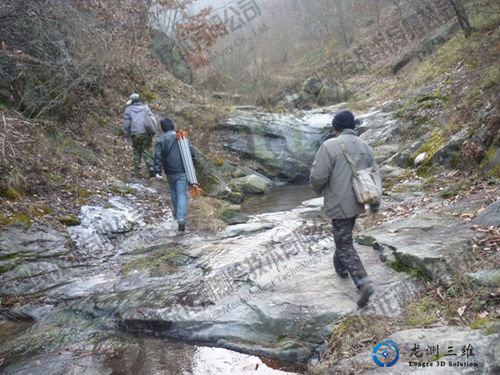
Yesterday, the Shaanxi Provincial Administration of Surveying and Mapping and geographic Information released the results of the first phase of the "1:10000 Topographic Map Blank Area Mapping Project in Qinling Area of Shaanxi Province".By the end of 2014, after the mapping project was completed, the houses, river courses and even the narrow lanes in the Qinling Mountains could be displayed. The rich geographical information could provide inquiry services for people's travel and life.
Seven cities and counties have urban maps
In July 2012, the provincial government and the National Administration of Surveying, Mapping and Geographic Information Jointly launched the "Mapping Project for qinling Region, Shaanxi Province: 1:10,000 Topographic Map Blank Area".Yesterday, the results of the first phase of the project were released for the first time, mainly including digital orthophoto map, image map of some cities and counties in Qinling, Qinling Nature Reserve map, Qinling regional road network map 4 content.It is reported that 837 digital orthophoto images, about 20,000 square kilometers 1:10,000 digital orthophoto images.Mainly for Hanzhong Zhenba, Liuba, Foping, Yang County, Ankang Ningshan, Shiquan County, Shangluo City Zhen 'an county and other 7 counties.
The image map results of some cities and counties in Qinling, including ankang city, Shangluo City, Shangnan County and other 7 cities and counties, can visually see the urban landscape of water systems, roads, government agencies, schools, hospitals, enterprises and institutions, villages, etc.
The map results of Qinling Nature reserves mainly include 1 qinling nature reserves distribution map and 31 national or provincial nature reserves map.It not only shows the water system, roads, nature reserves and other elements, but also shows the geographical location, animal and plant resources distribution and other information of each reserve in detail.
The results of road network map of Qinling region include 1 general road network map of Qinling Region and 4 separate road network maps of Ankang, Baoji, Hanzhong and Shangluo.You can see expressways and national, provincial, county, township and special roads, providing convenience for the public to travel.
Next year, we will draw a three-dimensional image of the Qinling Mountains
It is reported that the 57,000 square kilometers of Qinling Mountain area is still a 1:10,000 topographic map blank area, seriously restricting economic development.
The Qinling Mapping project involves 38 districts and counties in 6 cities including Xi 'an, Baoji, Weinan, Hanzhong, Ankang and Shangluo, covering 57,000 square kilometers, accounting for about 28% of the total area of our province.It is implemented by the provincial government and the National Administration of Surveying, Mapping and Geographic Information, with a fund of nearly 200 million yuan. It is the largest surveying and mapping key special project in the history of our province with the largest financial investment.
By the end of 2014, new topographic maps and 3-d images of the Qinling Mountains will have been produced, including houses, houses and even trails.
Accurate topographical maps will keep travelers from getting lost
In the future, the Shaanxi Provincial Bureau of Surveying and Mapping Geographic Information Will extract the data and information that people care about from the database and load it on "Map of The Earth and the Earth · Shaanxi" (the most authoritative electronic map in China). With the click of a mouse, citizens can view the Qinling Mountains from various angles and have a full view of its geographical features.
In addition, the data will provide services for regional economic planning in the Qinling Mountains, implementation of the Xi 'an-Chengdu high-speed railway, diversion of water from Shaanxi to Han, relocation of people from southern Shaanxi, ecological protection in the Qinling Mountains, tourism development and other provinces' hundreds of key projects.In addition to the image of topography, it can also quickly provide information for geological disasters, emergencies, emergency rescue.

 Sweep WeChat yards pay attention to us
