Hello, welcome to Nanjing Longce surveying and Mapping Technology Co., Ltd!
语言选择: ∷ 

Austrian Surveying and Mapping Company: NavVis VLX Brings Mo

Release time:2021-01-28 15:23viewed:times
Austrian Surveying and Mapping Company: NavVis VLX Brings More Flexibility
 
Vermessung Schubert is a traditional mapping service provider based in Vienna, Austria. VS focuses on non-enterprise customers, including some large municipal governments, infrastructure contractors, and the increasingly large group of architects and planners.
 
"Our partnership with NavVis began in 2016," said Martin Oberzaucher, Manager Director of Vermessung Schubert. "We apply NavVis technology to the digital construction of existing buildings, which is commonly known as' digital twin '. We use the point clouds captured by NavVis products to build floor plans and building models."


VS is also one of the beneficiaries of NavVis VLX Pioneer Project. "We are very honored to join the VLX Pioneer Project and become a pilot customer".
 

NavVis VLX brings more flexibility
In the actual test, Vermessung Schubert chose to match the existing NavVis M6 with NavVis VLX to complete a project. The project site is located in VAZ, St. P ö lten, Austria. It is the largest activity site in the area which is used for host festival parties, fairs, concerts, etc.
 
"Our main measurement task at VAZ St. P ö lten is to update the existing plan and use it for facility management," said Manuel Stoberl, a digital engineer at Vermessung Schubert. "We used both NavVis M6 and NavVis VLX throughout the project." The planning team used the NavVis M6 to scan large areas, such as central lounge restaurants.
 
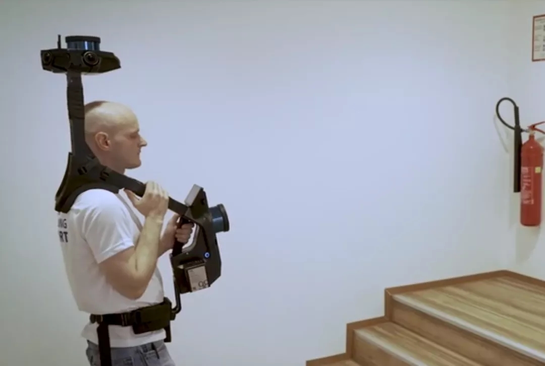
For smaller and difficult-to-measure areas, including kitchens, refrigerators, toilets, stairwells, small offices on the second floor, and building equipment rooms, they used NavVis VLX.


"Using NavVis VLX in those areas, you will feel that the measurement is much more flexible," Manuel said, "it will be also much more efficient."
 

NavVis VLX Compatible Control Points
Recalling his previous experience of using handheld devices, Manuel was surprised by the progress shown by the NavVis VLX. He described it this way: "Usually we use a handheld laser scanning device, but we only use it in a very small single room."
 
The other device they are using lacks a key point: it cannot record control points. Without this condition, in order to obtain a more reliable reference point, the user must scan the same place twice, and the whole process is very troublesome and time-consuming.
 

" With the Navvis VLX, this is no longer a problem." Manuel said so. "Because we can use control points (ground-wall) and targets to measure buildings. This also means that we don't need to make extra efforts to create a reference point."
 
For survey-grade accuracy and automatic dataset alignment, NavVis VLX is compatible with ground and wall control points. It can be easily recorded just aim at the target.
 

Vermessung Schubert was very surprised by the results of this experiment and expressed a strong desire to change from a pilot customer to a NavVis VLX user.
 
"After cooperating with NavVis, Our digital building department has doubled in size. " Martin Oberzaucher said so. "We have twice the number of employees and the same amount of turnover. Across the industry, you can clearly feel that you are leading the digital process."


龙测三维-三维扫描仪-3D扫描服务-FARO法如Sweep WeChat yards pay attention to us

  • Quotation and presentation requestliuchunlei@longce.net

  • The mobile phone+86 13851969931

Nanjing Longce Measurement Technology Co., Ltd  Address:No.15 Xinghuo Road, Jiangbei new district, Nanjing,China. ICP:苏ICP备20044645号-1