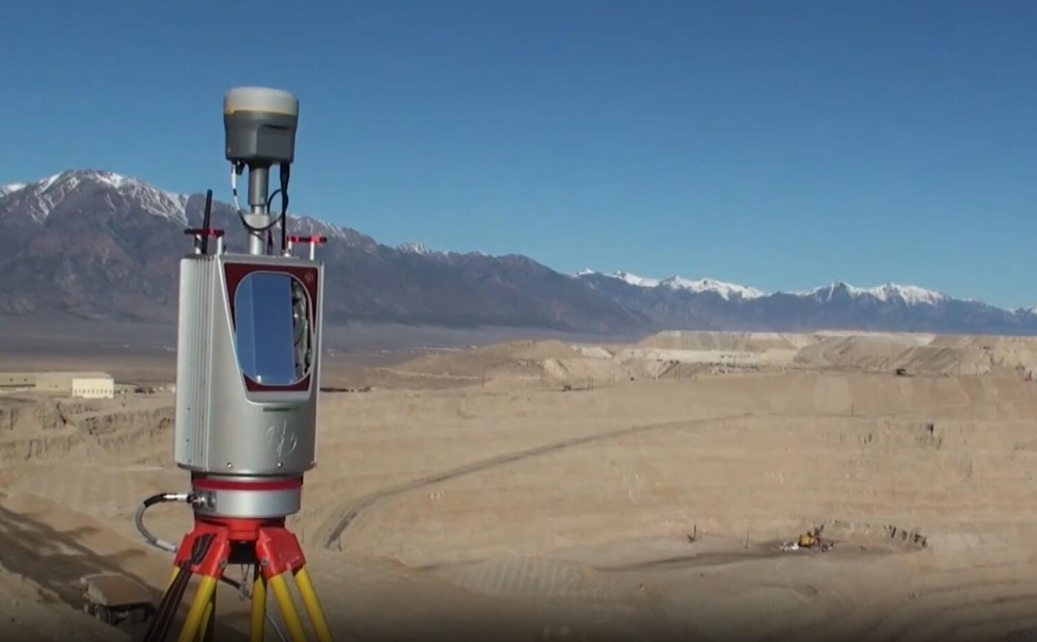
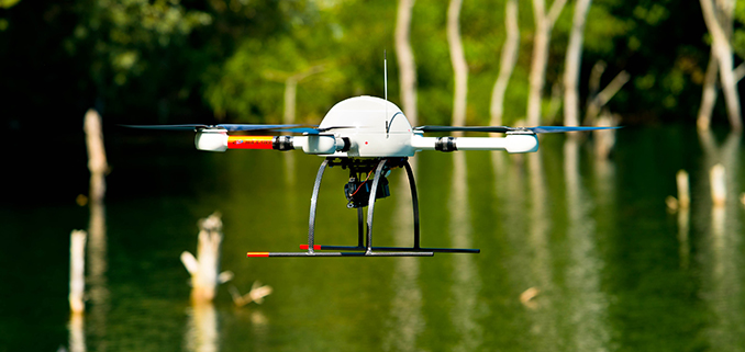
The power system of MD4 series quadrotor UAV has been tested in high-voltage electromagnetic environment, and has been confirmed to have good anti-interference and safety in high-voltage electromagnetic environment.

NO.2 The Ground console system
The Ground console system of MD4 series quadrotor UAV includes three defense workstation computers, digital communication and video processing system which meet the US military standards. Using Intel Core ™ I5-520m, with excellent processing performance, can compile intelligent information obtained from various information devices. The combination of ultra-high screen brightness and anti reflection technology ensures the visibility in direct sunlight. The backlit keyboard ensures that the ground station can still be operated conveniently in the night environment. The customized military I / O interface is configured to make the I / O interface fully conform to the military standard. Through the certification of mil-std-810g, mil-std-461f and IP65, all magnesium aluminum alloy casing can be operated under severe environmental conditions such as high temperature, cold, dusty and rainy days. It has good anti dropping performance, and it will not affect the use even after rough transportation.
Technical parameters of ground workstation
Intel & amp; 174 core i5-520m processor, 2.4GHz, 15.6 "TFT LCD HD (1366 x 768) 1000 nit high brightness display, 2GB ddr3320gb shockproof and pluggable hard disk, LED backlight film keyboard, digital microwave receiver, broadcast class video distribution amplifier, professional video collector, USB2.0 / eSATA, LAN, HDMI, 802.11 a / B / g / N, SMA digital microwave antenna interface X2, BNC. Video output x1, RAC video output x1, lithium ion intelligent battery (8700mah)
·It has passed mil-std-810g and IP65 certification
·Passed mil-std-461f certification
·Operating temperature: - 20 ° C to 60 ° C
·Storage temperature: - 51 ° C to 71 ° C
·Humidity: - 95% RH, non condensing
The Ground console system of MD4 series UAV system integrates mdcockpit cockpit instrument software independently developed by German microdrones. It can receive and view the complete flight data and video images taken by the aircraft in real time. It can also carry out waypoint autopilot route planning and design, and analyze the "black box" data brought by the aircraft.
NO.3 Remote control system
The MD4 series quadrotor UAV system adopts a specially designed digital coding remote controller with built-in duplex data transmission radio. The transmitter power of the radio is adjustable and works at 900m frequency band with frequency hopping function, which is stable and reliable. In addition to the normal remote control function, the remote controller can also receive and display a variety of important flight data in real time, so that the operator can operate independently from the ground station system when performing tasks. The remote control distance is not less than 3 km, and vehicle mounted antenna can also be selected.
Technical parameters:
·Communication frequency: 902mhz-928mhz
·Transmitting power: 10mw-1000mw (adjustable)
·Control channel: 14ch
·Remote control distance: more than 3000m
NO.4 Airborne equipment
1. Digital camera: 1400mp, 5 times optical zoom, tilt and roll control camera pan tilt, anti shake function, 8GB memory card, real-time aerial view on the ground.
2. High definition camera: 1080p, 3CMOS, 12x optical zoom, optical / electronic multiple anti shake, double axis gyro stabilized pan tilt head with controllable pitch and roll.
3. Daylight color camera: 520TV lines pal
4. Low light level black and white camera: 0.0003lux, 600TV lines pal, f1.4
5. Infrared thermal imaging camera: vanadium oxide uncooled focal plane array, 8 ~ 14 μ m, 320x240, 25Hz,
NO.5 software system
Mdcockpit cockpit instrument software based on Microsoft Windows TM operating system integrates many functions such as flight planning, flight monitoring, flight data analysis and so on. Downlink decoder can receive and display various flight data of the aircraft in real time, including battery voltage, coordinates, altitude, direction, attitude, flight time, flight speed, flight path, distance from the takeoff point, ambient temperature, wind speed, motor working state, remote control signal strength, GPS status and other important information. The flight data playback system can simultaneously save all flight data for post flight data analysis. Even in the manual remote control flight mode, as long as the system is equipped with electronic map or image map data of the current operation area, the system can display the position of the aircraft on the map in real time. Waypoint software may help you create detailed flight route planning with the help of waypoint planning editor, so that the aircraft can automatically fly according to your planned route. In addition to planning flight routes, a variety of shooting plans can also be set, such as fixed-point 360 degree panoramic shooting, surround shooting around fixed-point targets, fixed distance along the flight route, and fixed-point shooting.
NO.6 Training machine
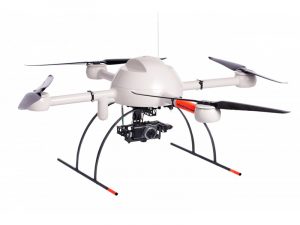
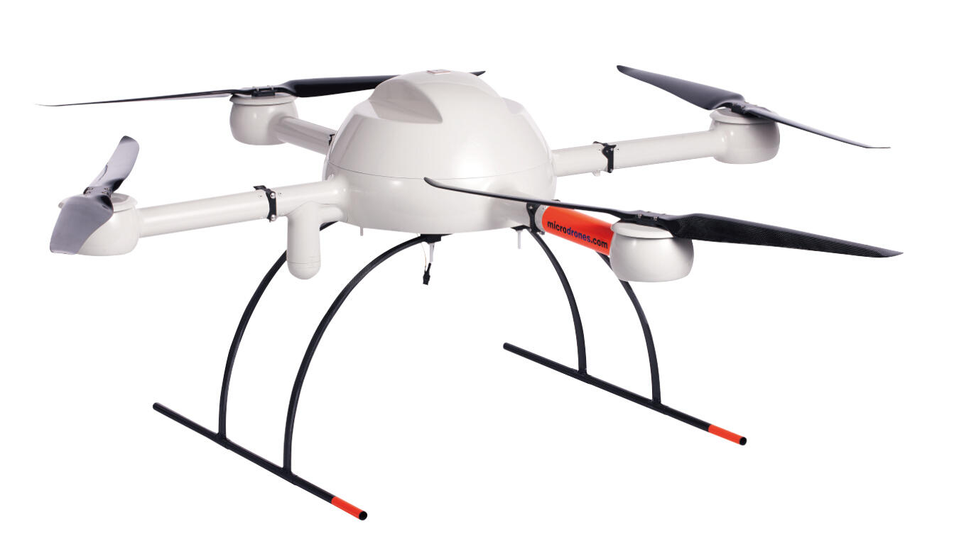
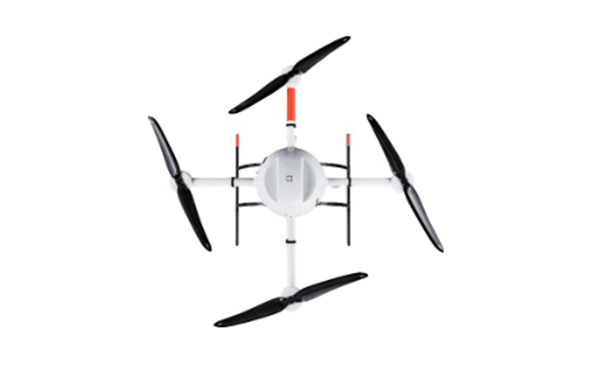
Md4-1000 training aircraft adopts semi carbon fiber open and easy to repair structure design, including flight control board, navigation version, IO board, four 250W external rotor brushless motors, tightly integrated GPS / INS, including three-dimensional magnetometer, 2.0B can bus support, folding arm, front and rear rotors X2, left and right rotors x2 and landing gear. The flight characteristics of the training aircraft are very similar to those of the equipment aircraft, but the cost of structural parts is low and easy to repair and replace. It can be used for operators to master the remote control control flight and carry out special flight skills training at the beginning stage, which can reduce the cost of daily training loss and reduce the psychological pressure of operators.
Md4-200 training aircraft adopts semi carbon fiber open structure design, including direct drive brushless motor, flight control system, navigation system, high sensitivity GPS receiver, 3D magnetometer, landing gear, rotor, RC antenna and black box system. The flight characteristics of the training aircraft are very similar to those of the standby aircraft, but the structure cost is low and it is easy to repair and replace At the stage, mastering the remote control control flight and carrying out special flight skill training can reduce the cost of daily training loss and reduce the psychological pressure of operators.
NO.7 Charging equipment
The 1000 type charging box has a completely independent two-bit battery balanced charging bin, equipped with two 20A / 400W high-power chargers, which are built into the military standard safety box, and can charge two md4-1000 special batteries at the same time.
The charging control panel adopts touch control key. It has multiple protection functions such as charging current regulation, temperature protection, over-current protection and short-circuit protection.
NO.8 Application:
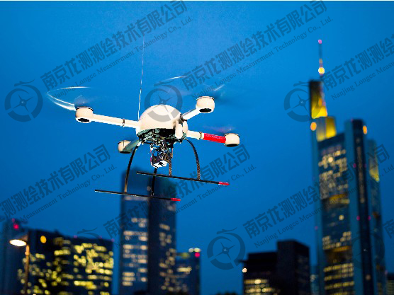
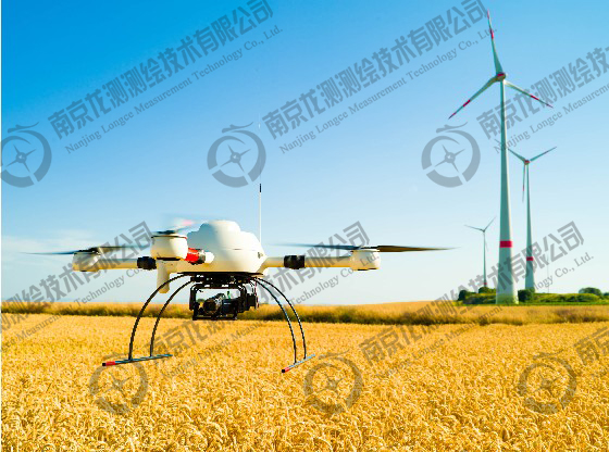
a. Hoverable drones,It is mainly used for dynamic image observation and real-time measurement of emergency disposal site. MD4 series quadrotor UAV is the world's leading small-scale automatic piloting UAV system with excellent safety design. Whenever the remote control operation is stopped, the aircraft will automatically hover in the air. Therefore, it can be used for dynamic image observation and real-time measurement of emergency disposal site.
b. The dynamic images in flight should be able to transmit back to the ground in real time, and support instant photography
The ground station system of MD4 series UAV system integrates mdcockpit cockpit cockpit instrument software independently developed by German microdrones, which can receive and view complete flight data and video images taken by aircraft in real time. Therefore, the dynamic images in flight can be transmitted back to the ground in real time with a transmission distance of 3 km;
The remote control system of MD4 series quadrotor UAV supports the real-time control of airborne mission equipment. The remote controller can be operated on the ground to take photos, video and zoom on the airborne mission equipment. It can also roll and pitch the PTZ of the airborne mission equipment in real time.
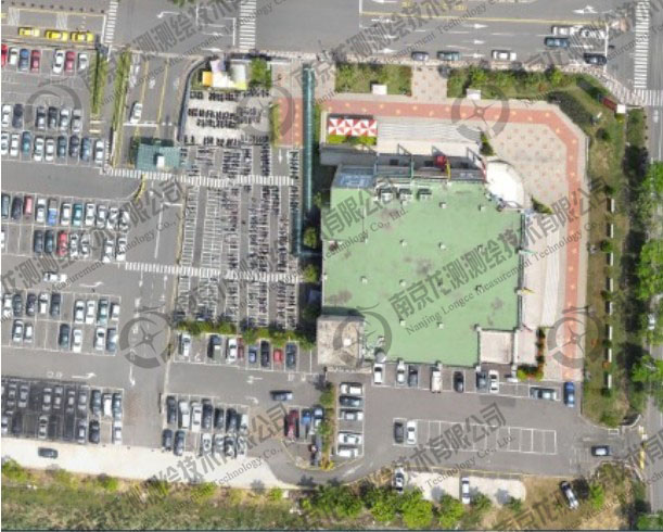
c. It can realize fast mapping, such as DEM map, which is convenient for leaders to make decisions. Through professional UAV image processing system, it can quickly plot and facilitate leaders' decision-making.
d. It can realize ground remote control and real-time video transmission
 ∷
∷ 


 Sweep WeChat yards pay attention to us