Hello, welcome to Nanjing Longce surveying and Mapping Technology Co., Ltd!
语言选择:  ∷
∷ 
∷ ∷ 


| 国土规划 | 公路、铁路带状制图 | 水利、水资源监制 |
| 地理国情普查 | 输油(天然气)管线设计 | 露天矿测量 |
| 城镇三维建模 | 地质、洪涝灾害应急 | 不动产登记 |
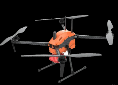
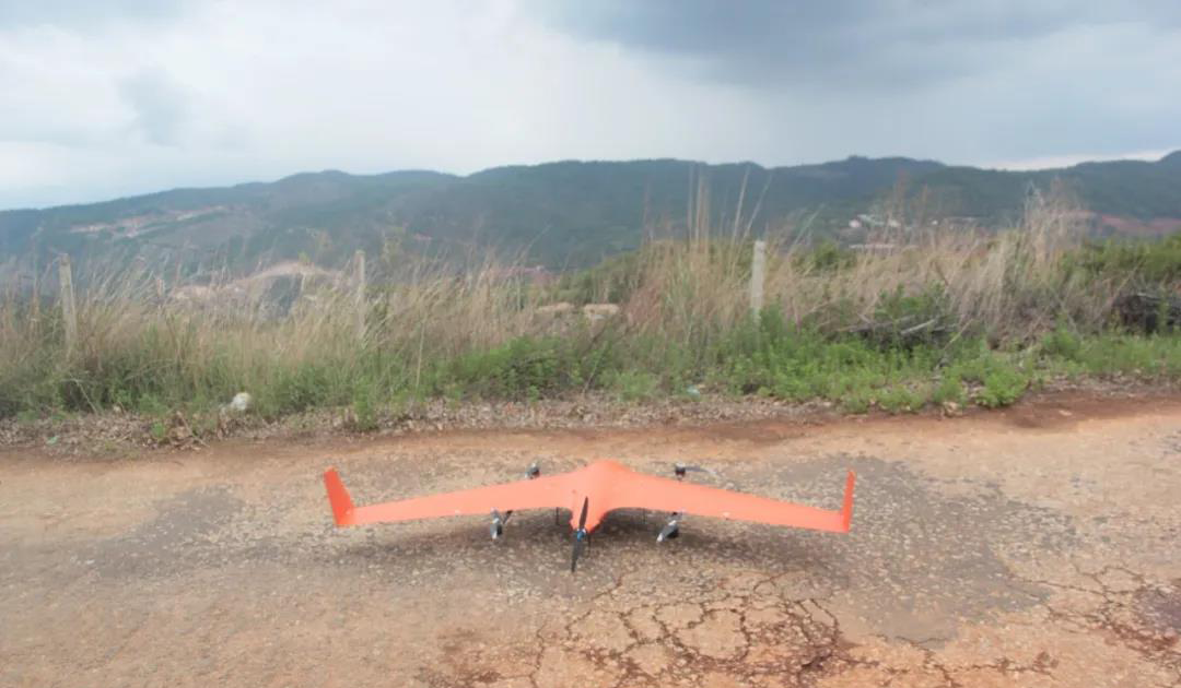
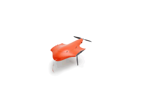
| More accurate | Safer | more flexible | More tough |
| Built-in FlndCM,FlndTrace service | Three redundant independent system, foolproof | 5 meters range, automatic take-off and landing | Level 7 wind resistance, plateau work |
| More rigorous | More reliable | A more stable | More efficient |
| Full - domain image - free control, high precision camera trigger time synchronization | Equipped with two fixed rotor wing power devices, power failure automatic switching | Health navigation signal abnormal autonomous landing function | Battery voltage protection function |
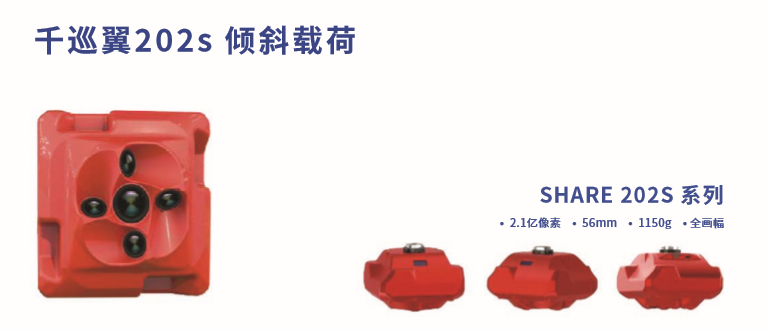
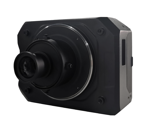
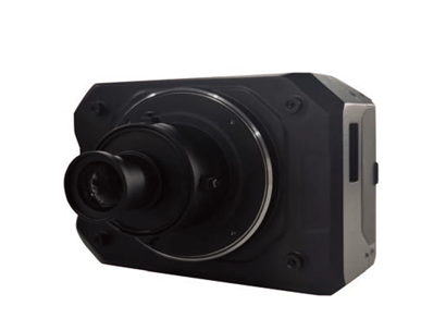
Camera model: Sal 102S
Number of cameras: 5
Sensor Size: APS-C (23.5x15.6mm)
Effective pixels: 120 million (24 million x5)
Lens parameters: normal 25mm fixed focus, tilt 35mm fixed focus X4
Exposure interval: better than 0.8 seconds
Weight: 600 g
Airborne power supply, customized mechanical low distortion lens, high synchronization design.
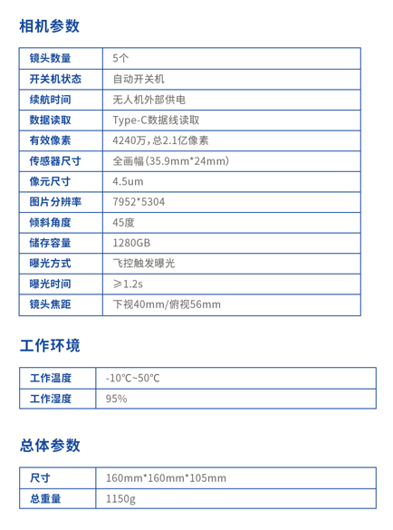
Camera model: Aerial version - SONY A7r2
Sensor size: 35.9x24mm (full frame)
Effective pixels: 42 million (7952x5304)
Lens parameters: Lightweight custom aerial determination focal point 40mm lens
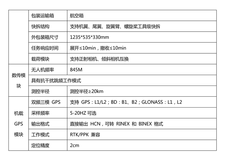
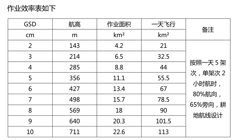
Resolution: 2cm@177m
Flight altitude: 150m-1500m
Airborne power supply, customized aerial determination focus low distortion lens, customized anti - shake body
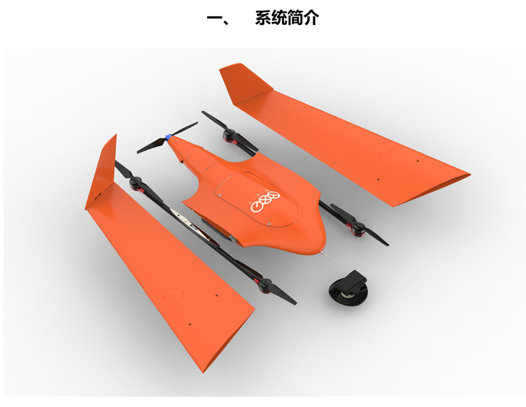
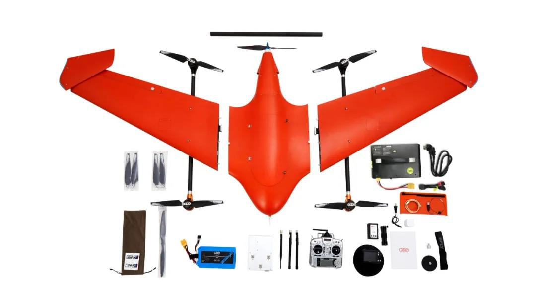
Ultra light weight fuselage, easy to carry
CNC alloy housing, effective heat dissipation, protection upgrade
Excellent integrated design, no fear of outside natural interference of aerial survey
Match searle aerial survey steward for data preprocessing


 Sweep WeChat yards pay attention to us

Quotation and presentation requestliuchunlei@longce.net

The mobile phone+86 13851969931
Nanjing Longce Measurement Technology Co., Ltd Address:No.15 Xinghuo Road, Jiangbei new district, Nanjing,China. ICP:苏ICP备20044645号-1