JRC 3D Reconstructor 3D dot cloud processing software
JRC 3D Reconstructor, a powerful 3D point cloud processing software from Gexcel, specializes in processing ground 3D laser scanner data and 2D images. At first, the software was designed and mainly applied in industrial workshops, but now it has been extended to the field of architecture and civil engineering.
JRC 3 d Reconstructor integrate multiple modules and coordinates, through 3 d laser radar data, high resolution RGB images, global navigation satellite system, and the three-dimensional measurement point of terrain management, can more easily handle different types of laser scanner have access to different formats, different sources (ground, mobile, airborne) of 3 d data, fully compatible with all major on market at present is laser scanner data format.
|
|
Application Field:
|
Main Achievements:
|
High level terrain survey
Civil engineering
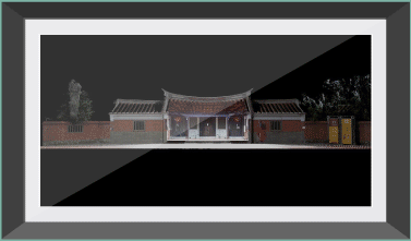
Cultural heritage
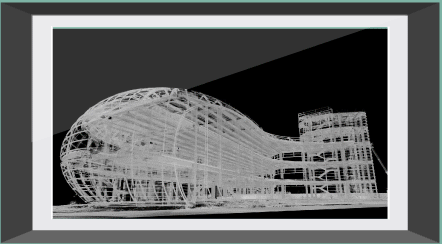
building
The tunnel
mining
verification
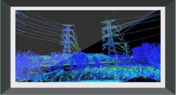
Industrial plant monitoring
|
High resolution RGB image
A photorealistic 3d model
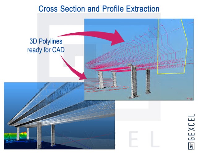
Cross section extraction
Animation recording
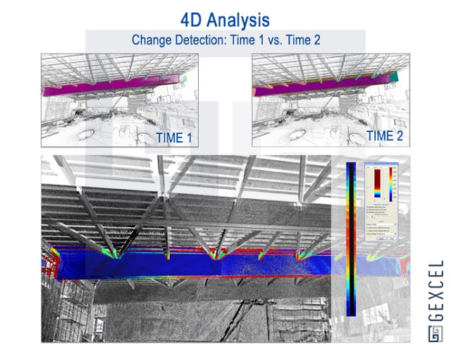
Deformation monitoring
Crack measurement
Geological landforms
Landslide monitoring
Analytical rock break
|
|
|
|
JRC 3D Reconstructor-full Educational four modules
- JRC 3D Reconstructor - HERITAGE
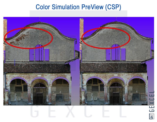
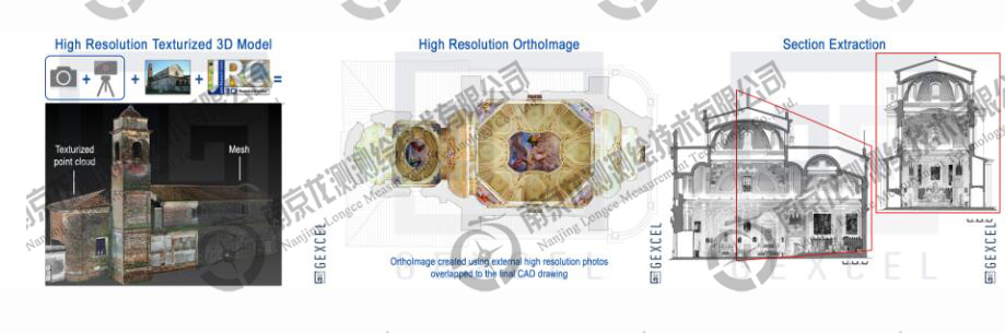
. Software can calibrate color images and project them onto grid models, effectively using grid tools or third-party software to create grids based on point clouds.
. RGB images at all resolutions can create highly realistic 3D models.
. JRC 3D Reconstructor-Heritage is an essential software for cultural HERITAGE, architecture and high-level civil engineering applications.
. Software can easily create photorealistic 3D models and orthophoto images and generate aerial views.
. The software can be used to find cracks in concrete structures and analyze detailed images, as well as to measure and protect cultural relics, artworks, archaeological objects and cultural sites.
- JRC 3D Reconstructor - CONSTRUCTION
|
|
Processing modules designed especially for the construction, infrastructure, and civil engineering sectors.
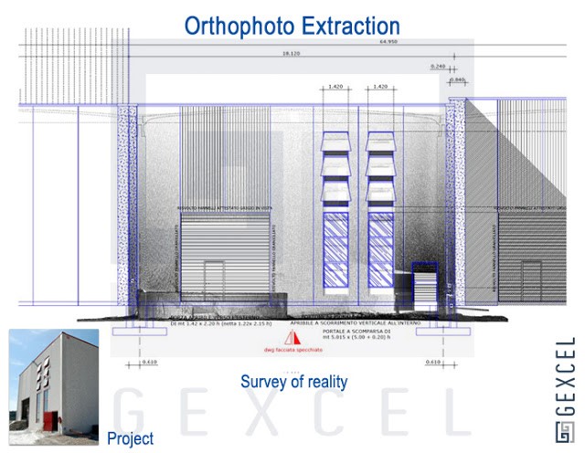
Easy access to cross sections, building facades and orthophoto images.
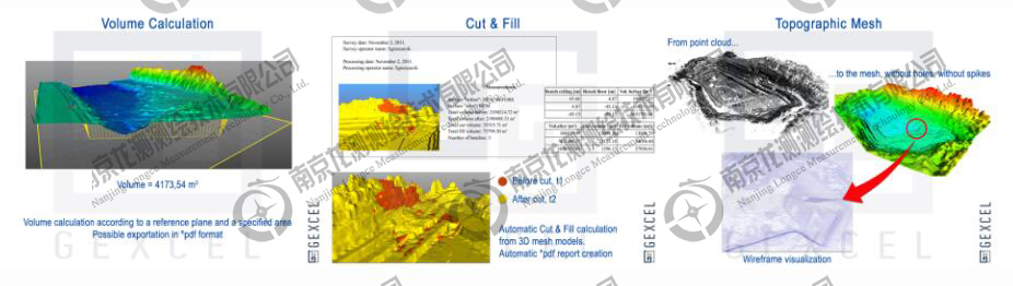
The software can provide deformation and displacement diagrams, as well as calculations of area and volume directly from laser data.
All the 3d model results can be imported into CAD software.
Software can provide a high level of semi-automated splicing.
Point cloud data can be fitted and converted using external control points, total station or GNSS measurement points.
The software's georeference tool can support many cartographic coordinate systems (such as WGS84).
|

- JRC 3D Reconstructor - MINING
. A treatment module designed specifically for geological and geotechnical engineering problems in mining areas, tunnels, and areas.
. The 3d information points of GNSS or total station can be obtained and combined with laser data effectively.
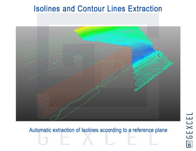
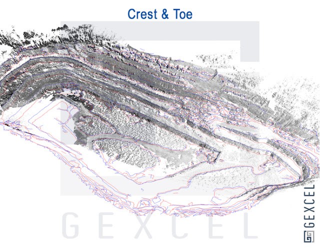
. It can support extraction of characteristic lines of mining area and cave measurement data, extraction of peaks and valleys (mine break lines), generation of DTM, filling and excavation report, extraction of section and acquisition of elevation change color map.
. All the extracted data are compatible with CAD software.
- JRC 3D reconstructor-photo
. Developed for users who already use third-party software to structure grid data, this module can calibrate projected full-resolution images, create photorealistic 3D models, and obtain orthoimage.
. As with JRC 3D reconstructor-Heritage, the JRC 3D Reconstructor-photo module provides analysis and output (high resolution orthoimage) capabilities.
. Fully compatible with all major laser scanner data formats currently on the market.
Gexcel R3
Gexcel R3 is a tool included with JRC 3D Reconstruct-Software for visualizing and working with large point cloud data that has been edited by reconstructor-Software.
Based on Gexcel Xtream technology, Gexcel R3 enables you to view models that have been edited by JRC 3D Reconstructors, as well as large amounts of data from different sensors and sensing platforms.
Two modules of Gexcel R3
- Gexcel R3 View
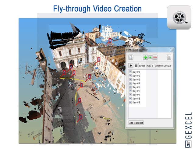
. Gexcel R3 View makes it easy to create an aerial View along user-defined tracks and adjust travel speed.
. Gexcel R3 View supports common video playback modes.
. Tracks for creating views can be set in Gexcel R3View or Reconstructor.
- Gexcel R3 Solid Image
. Create orthophoto images of 3d models composed of point clouds.
. Orthophoto can be imported into CAD, and the CAD plug-in allows the user to edit the imported orthophoto directly in CAD.
. Gexcel R3 Solid Image creates a normal Image that looks like "Solid Image", meaning that each pixel contains depth information for dimensioning in CAD.
. Using the paste tool, a high resolution "Solid Image" can be generated.
. It is easy to generate high resolution (such as 20,000 x 30,000 pixels) 3d building views.